Publications

OSS
978-9938-933-29-1
2020

Water in our regions

This work comes after two previous editions of monographs on water resources published by the Sahara and Sahel Observatory in 1995 & 2001.

It is a summary of useful data & information for decision-makers & managers, but also to every single person interested in water issues.

It also provides avenues for reflection & guidance to the different & relevant operators, in order to improve the management & development of water resources, in the area of intervention of the Sahara & Sahel Observatory.

Finally, this work has the particularity of being available in a modifiable digital Wiki-type format at the following address: www.oss-online.org/wikoss/moneau/en


Water
Water in the OSS Region
Water resources management
Monography
OSS
978-9938-933-19-2
2019

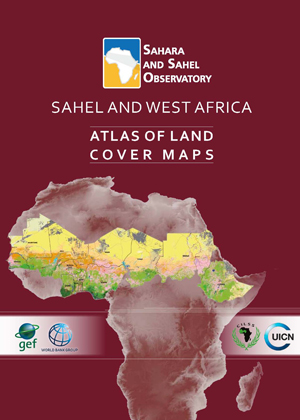
This regional atlas of land cover maps is meant to serve as a planning and decision-making tool in support of the Great Green Wall Initiative. It is intended for decision makers, development partners and the public audience. It was designed on the basis of satellite data of 30 meters resolution and covering 12 countries concerned by the Sahel and West Africa program - SAWAp (Benin, Burkina Faso, Chad, Ethiopia, Ghana, Mali, Mauritania, Niger, Nigeria, Senegal, Sudan, and Togo).

Through the cartography of land cover and the thematic synthesis describing the biophysical and socio-economic environment of the region, this product highlights the potentialities and assets of the Sahel and West African regions, while demonstrating their vulnerability and threats to the natural resources.

The reader could also fnd illustrations of the main ecosystems and their strategic role in socio-economic development and transboundary cooperation, to face global climate change.This publication is the result of close collaboration between oSS, CILSS, IUCN and the relevant technical departments within countries of the region, in the framework of the «Building Resilience through Innovation, Communication and Knowledge Services - BRICKS» project.

BRICKS
BRICKS Atlas
Land Management
Atlas
OSS
978-9973-856-87-6
2015

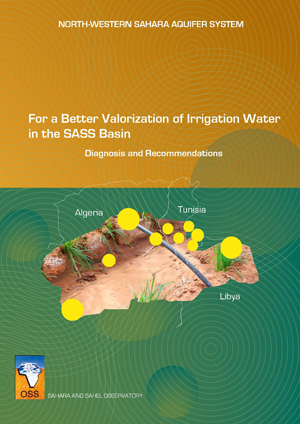
The North-Western Sahara Aquifer System (SASS) is a basin which extends over 1,000,000 km2 and is shared by three countries (Algeria, Tunisia, and Libya). The NWSAS water reserves are considerable yet generally of quasi fossil nature.

With the aim of enhancing sustainable development in the region, OSS in partnership with the three countries concerned, conducted, in a first phase, several studies that allowed a better hydraulic knowledge of the basin. However, given the growing water needs, notably relative to the agricultural sector, and the necessity to preserve a little renewable resource, OSS decided to undertake a study on water valorization in the basin.

The study was structured around two components:

  • A socio-economic component focusing on analyzing the operation modes of agricultural systems and especially on understanding the irrigator’s behavior by conducting several surveys realized with almost 3,000 farmers. This analysis enabled to identify the main constraints to water productivity, to measure their economic impacts and to elaborate operational recommendations for a better valorization of the basin’s resources.In addition, a hydro-economic model was developed with the objective of providing decision makers with an efficient decision-support tool to help them develop and implement agricultural development policies.
  • A second “demonstration pilots” component concerned the implementation of six demonstration NORTH-WESTERN SAHARA AQUIFER SYSTEMpilots by the farmers themselves dealing with different issues and problems faced by the three countries. The technical innovations introduced at the pilots level aimed at intensifying cropping systems, saving and valorizing water. The results obtained following two agricultural seasons helped confirm the existence of efficient technical solutions for the renovation and implementation of agricultural systems at the farm level.

The results obtained by the study allowed to conclude a number of recommendations for a sustainable development as well as for a better preservation of the basin’s resource.

SASS
For a Better Valorization of Irrigation Water in the SASS Basin
Water Resources Management
Etudes & Rapports
OSS
978-9938-933-06-2
2017

Surface and ground waters are a strategic asset for the West Africa sub-region and play a decisive role in the economic and social development in the countries of the region. Further studies should be conducted on the Iullemeden and Taoudeni/Tanezrouft Aquifer Systems (ITTAS) and how they function in order to support the development efforts of the ITTAS countries. Greater knowledge of the hydrological connection between the aquifer systems and the Niger River is a prerequisite to improving the management of the systems’ surface and groundwater resources.

It has been taken up in the GICRESAIT project, which was funded by the AWF and FFEM (total amount 1,728,000 €), and implemented by OSS from 2010 to 2016, with the participation of seven countries (Algeria, Burkina Faso, Mali, Mauritania, Niger and Nigeria).

Project outputs are :

  • Signifcant increase in knowledge about the Iullemeden and Taoudeni/Tanezrouft water resources, which together form a single transboundary aquifer system 
  • Identifcation of areas with a major groundwater potential
  • Creation of a regional database
  • Study of themes such as hydrogeology, land cover, aquifer recharge, piezometry, vulnerability to climate change, water-table pollution
  • Facilitate the adoption of a Memorandum of Understanding and a road map for the creation of a Consultation Mechanism for the joint management of the ITTAS shared groundwater resources.
GICRESAIT
GICRESAIT | Summary report
Water Resources Management
Plaidoyer
OSS
978-9938-933-02-4
2017

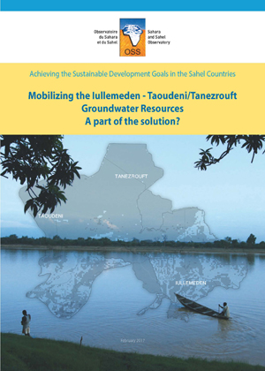
The groundwater resource of the Iullemeden-Taoudeni Tanezrouft Aquifer System shared by 7 countries (Algeria, Benin, Burkina Faso, Mali, Mauritania, Niger and Nigeria) is increasingly threatened in terms of quantity and quality. The GICRESAIT regional project "Integrated and concerted water resources management of the Iullemeden, Taoudeni/Tanezrouft and Niger River Aquifer Systems" (2010-2016) assessed the potential resources and ensured its monitoring and vulnerability to climate change. This work has highlighted the importance of the resource with no less than 7 high potential areas, and its low vulnerability to climate change. This should be part of the solution to the major challenges of groundwater mobilization in the countries concerned and help them achieve the main objectives of sustainable development.

GICRESAIT
GICRESAIT | Note for decision-makers
Water Resources Management
Plaidoyer
OSS
978-9973-856-15-4
2017

Monitoring and evaluation is a crucial component of the MENA-DELP regional and national projects activities.

In this framework, a series of regional workshops aimed at projects managers and the MENADELP national beneficiary institutions were conducted to accompany countries in designing their monitoring and evaluation systems. A technical support to the projects national teams for the development of indicators calculation and dissemination tools was also provided by the Sahara and Sahel Observatory.

Different monitoring and evaluation related themes and notions were tackled : 

  • Monitoring-evaluation concepts : monitoring-evaluation models, indicators and data, result-based management, etc … 
  • Monitoring-evaluation tools : Geographic Information System, remote-sensing 
  • GEF tools : tracking tools and Risk Assessment
  • Mapping and Collect Earth Tool (FAO)
MENA-DELP
MENA-DELP | Monitoring & Evaluation
Land Management
Studies & Reports
OSS
978-9938-933-05-5
2017

This atlas is meant to be used by decision-makers, development partners and the general public.
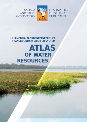
The purpose of the atlas, containing some 30 maps and graphs derived from an OSS regional study on the Iullemeden, Taoudeni/Tanezrouft Aquifer System, is to provide information on the availability and use of water resources in this region of seven countries (Algeria, Benin, Burkina Faso, Mali, Mauritania, Niger and Nigeria).
The atlas also offers the reader illustrations concerning water and the strategic role it plays in transboundary cooperation, food security, health, and socio-economic development to help cope with global changes.

GICRESAIT
GICRESAIT Atlas
Water Resources Management
Atlas
978-9938-933-16-1
2017

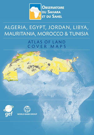
This Atlas includes land cover maps of Algeria, Egypt, Jordan, Morocco, and Tunisia. It is intended to decision-makers, development partners and the general public. 
Through some fifty maps and a brief multi-thematic explanation, this Atlas aspires to highlight the linkages between ecosystem services and populations livelihoods in desert areas and their potentialities.

The reader will also find illustrations about the major ecosystems of the project area and their role in transboundary cooperation and socio-economic development to address global changes.

MENA-DELP
MENA-DELP Atlas
Natural Resources Management
Atlas
OSS
978-9973-856-27-2
2008

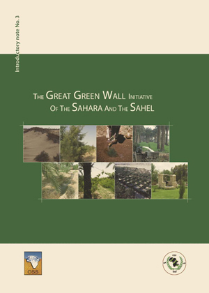
This note summarizes the results obtained from available documentation and consultations with key experts and practitioners. It draws lessons from past experiences while considering current development needs. The Great Green Wall Initiative, has not been conceived as a wall made up of trees planted across the Sahara, but rather as a set of cross-sectoral actions and interventions aimed at the conservation and protection of natural resources with a view to achieving development and, particularly, alleviating poverty.

Great Green Wall Initiative
Land Management
Advocacy
Ahmed Aïdoud
978-9973-856-32-6
2008

The long term ecological surveillance observatories network (Réseau d'observatoires de surveillance écologique à long terme, ROSELT/OSS) of the Sahara and Sahel Observatory (OSS) consists of a cluster of observatories which span circum-Saharan Africa and share a common focus on the issue of desertification. Since its inception, the network has been addressing the challenge of improving the collective knowledge on desertification; a scourge that has complex linkages with the issues of biodiversity and climate change.

Over the last ten years, OSS has put in place standardised protocols of data collection and processing in the circum-Sahara with a view to apprehending the trends characterising the evolution of the ROSELT/OSS observatories’ ecological and socio-economic systems. In this part of Africa, where rainfall decrease is chronic in the Sahel and spreading to North Africa, population growth and land use change—due to overgrazing or the conversion of rangelands into croplands—have adverse impacts on the environment. In addition, sand encroachment constitutes a serious threat to irrigated farmland. Biodiversity is equally affected, as several species face the danger of extinction due to human activities.

In the south of the Sahara, natural resource depletion is often among the causes for migration towards the zones where climate and life conditions are more favourable. This forced displacement is significantly less severe in the north of the Sahara where policies put in place by governments in the sub-region encourage sedentary lifestyles.

Based on the scientific reports of the ROSELT/OSS observatories, this publication provides an overview of the data management systems and the decision-support tools developed across the ROSELT/OSS network. It also highlights difficulties pertaining to environmental surveillance in North and West Africa.

ROSELT
ROSELT/OSS experience
Environmental Monitoring & Biodiversity
Studies & Reports