Publications

OSS
978-9973-856-97-5
2017

The BRICKS project has been designed to facilitate the fulἀllment of these needs. In fact, the project provides a regional platform to spur exchanges with a view to conducting common actions among the 12 Sahel and West African countries of the SAWAP program. The common objective is to improve countries access to best practices and monitoring information in terms of sustainable land use and management in SAWAP portfolio.

Elaborated within the framework of the BRICKS project, the present guide represents a common core for the implementation of the monitoring and evautaion system of the SAWAP portfolio. It aims to consolidate and support the different monitoring and evaluation systems of the national projects.

BRICKS
Guide for the monitoring-evaluation
Environmental Monitoring & Biodiversity
Studies & Reports
OSS & IGAD
978-9973-856-59-3
2011

Several socioeconomic challenges have underscored the analysis of the water resources of the IGAD Sub-region and their uses. The countries of the sub-region are in an era of serious water shortages, which raises the spectre of looming water insecurity and the prospect of intensified competition for water in the future. The main challenge for the sub-region is, among others, how the water resources will be managed to meet rising food demand while at the same time protecting access of the poor and vulnerable people to the water that sustains their well-being.

This report is based on national data which were significantly complemented and where necessary upgraded with complementary data and information from regional and international sources. To achieve the desired results more effectively, the study focused the assessment and analysis of water use in the most important water-using sectors (this was largely dictated by lack or inadequacy of data for the other sectors), namely water uses in the domestic, agriculture and industrial sectors.

Two models (Water Use Model and PODIUMSIM Model) were examined for potential application in the quantification, assessment and projection of water use. Both models provide tools for simulation of alternative scenarios of future water demand with respect to the variations of the key demand drivers. While the full application of the models was proscribed by insufficient data, they nonetheless provided the conceptual framework used in this study to work projections and scenarios of future water demand.

Key results of the socioeconomic component included, firstly the detailed assessment of the key drivers of water demand in the sub-region, and secondly the projections of future water needs in various scenarios.

While several factors will drive the pressures on water resources, population and its dynamics will be the primary driver of all demands, including water demand (Chapter 6). High population growth is outstripping the pace at which water resources are being developed to meet the various socioeconomic needs of the sub-region. Associated with this is the low and unbalanced funding of the water and sanitation sector, with the tendency to concentrate water infrastructure in the urban centers and giving lower priority to rural areas.

The water issues of the sub-region are exacerbated by the fact that over 75% of the sub-region is classified as ASAL – these areas which are mostly water stressed and have low agricultural potential.

This report made recommendations (i) on population and its impacts on water demand; (ii) on adjustment of water demand and food security; and (iii) on data and data sharing

IGAD
Socioeconomic component
Water Resources Management
Studies & Reports
OSS & IGAD
978-9973-856-60-9
2011

The report is built out of three key environmental thematic areas: drought and desertifica-tion; flooding and erosion risk; water quality and pollution. These three areas were covered at national and sub-regional levels, meaning that the volume contains analysis of each of the 7 IGAD Member States and a general sub-regional analysis for each thematic area.

Large areas of the IGAD sub region are arid, semi-arid or desert with more than 50% of their land mass regarded as arid or semi-arid in some of the countries. The impacts of climate change and variability are therefore felt directly by these countries, especially the most vulnerable rural populations. The arid and semi-arid lands are mainly inhabited by the itinerant pastoralists and nomads, some of who combine pastoralism with agriculture. However their habitats are being denuded of vegetation – especially the forests – leading to wider environmental impacts such as land degradation, reduction in ground and surface water resources, pollution of the soils and waters, increased soil erosion and failure by the ecosystems to perform their roles in a sustainable manner.

The rapid population growth and poor socioeconomic structures in these countries make the future bleak for the vulnerable populations. The severity of flooding has increased in all the IGAD countries over the last few decades as a result of climate change and variability which makes rainfall become highly unpredictable.

The IGAD region is experiencing a surge in oil discoveries and will face the problems of increased pollution from exploration and exploitation of oil from the countries. Sudan is already experiencing severe problems with produced water during the exploitation of oil while Uganda is soon moving to the stage of producing oil in the Albertine Graben of Western Uganda.

An important footnote to this report is the fact of the independence of South Sudan from the Sudan which took place on 9 July 2011. This Report gives information that is valid for the combined State of Sudan. There was no opportunity to disaggregate the data to the two separate independent countries at the time of finalising this Report.

IGAD
Environmental component
Water Resources Management
Studies & Reports
OSS & IGAD
978-9973-856-61-6
2011

The major activities of the Database component have been to carry out the analysis of required entities and attributes for Database development, defining entity relationship model at Conceptual level and thereafter to carry out Database installation and testing, data conversion and semantic translation, data input into the database and data output generation.

Since this is the first sub-regional database for the IGAD member countries, a huge work have been done to come up with this useful tool for data management which cuts across several water resources (surface and groundwater) sub-disciplines. The Database built included both identification and variable data/information on borehole, shallow wells, Meteorological, hydrological and river gauging stations. In total, 83,064 (Eighty three thousand and sixty four) water points have been input the regional Database.

Data provided were quite heterogeneous, different formats and semantics. Efforts were made to harmonize them before their introduction into the Database. This operation can be improved by continuous treatment. The established GIS database enrichment will allow in the future updating the thematic maps produced by the project. This will also serve for national use and support for decision making.

The major shortcomings encountered during data compilation and analysis was as follows: lack of, or wrong coordinates; duplication; Lack of Identifier, etc.. There is a need to overcome the shortcomings and the lack of data by involving the national Coordinators from member countries. As Database construction is a continuous and dynamic process, this issue will be addressed in a further stage of the project

IGAD
GIS/Data Base component
Water Resources Management
Studies & Reports
OSS & IGAD
978-9973-856-62-3
2011

The Water Resources Modeling section conceptualized and developed of a hydrologic model for water resources assessment of the identified transboundary basins in the IGAD region. Despite the lack of data (meteorological data, daily stream flows, etc.) which limited the effective calibration of the model, several attempts were carried out to ensure effective estimation of the Water resources for the IGAD basins.

The evaluation of the hydrological performance of the SWAT model on a daily/monthly time resolution for the IGAD basins faced large deficiencies in the database, especially regarding daily observations - a number of observations are missing. Model calibration requires the availability of reliable flow data for major rivers within the basins in both temporal and spatial terms. These data were not available for the current study. Consequently, the study used the available data from other sources which are sparse and not free of errors. Furthermore, the model helped clearer understanding of the hydrological response of several IGAD catchments and the potential use. A simple sensitivity study helped reduce the dimensionality of the calibration challenge.

The Water Resources Modeling of the Six (6) identified transboundary river basins (Danakil, Gash-Baraka, Turkana-Omo, Ayesha, Juba-Shebelle and Ogaden) represent a first attempt to comprehensively model their water resources within the IGAD sub-region. For most of the basins, the estimated available annual water resources were in good agreement with results from other studies. As such the estimates for all basins need further investigations before they can be used as a basis for comprehensive decisions about the basins. There is need for collection of additional data from the member countries as soon as a mechanism for data sharing can be implemented.

The model assessed the available water resources for the IGAD transboundary basins to 182.8 km3 (111.3 km3 for Surface water and 71.5 km3 for Groundwater). Additional data especially daily stream flows at several locations in the basin, are required to improve the water resources simulations.

IGAD
Water resources modelling componenet
Water Resources Management
Studies & Reports
OSS & IGAD
978-9973-856-63-0
2011

Several transboundary river basins and aquifer systems have been identified in the IGAD sub-region. The basis of Integrated Water resources Management (IWRM) is that different uses of water are interdependent. These uses tend to have cross-border implications. Then implementing IWRM in transboundary basins provides a viable mechanism for addressing the challenges. The problem for most countries is the long history of unisectoral development. Water development and management should be based on a participatory approach, involving users, planners and policymakers at all levels.

It appears that modeling water resources management in the IGAD sub-region is challenging. Water resources are sparsely distributed in space and highly variable in time. Additionally, data on water demand and usage are scarce and can be unreliable in areas where they exist. Thus, the need for Water Evaluation and Planning were obvious.

The WEAP model was used for modeling water resources management in the IGAD sub-region. It allows to analyse the effect of polices interventions (both structural and non-structural) on water resources availability and demand in a region. The demand and supply data were collected at national and international level and used. The model was then successfully developed for six transboundary river basins in the IGAD sub-region. Alternative water management scenarios were simulated. The results have shown very optimistic results, ensuring that the IGAD sub-region has considerable water resources which, if well managed, can serve the needs of the basin inhabitants.

The implementation of IWRM is complicated by lack of political will, lack of institutional and legal tools and also lack of human resources capacity. An overall plan is required to envisage how the transformation can be achieved and this is likely to begin with a new water policy to reflect the principles of sustainable management of water resources. To put the policy into practice is likely to require the reform of water law and water institutions. This can be a long process and needs to involve extensive consultations with affected agencies and the public.

Training of model users will help in ensuring that the use of the model is integrated in their daily work and a critical mass of professionals can be built to implement the model at Transboundary basin level. The IWRM models were built from the data available at the time of analysis. The main idea behind the development of the models was the models will evolve over time as more information about water resources, demand and other policy issues becomes available.

IGAD
IWRM Composnent
Water Resources Management
Studies & Reports
OSS & UNESCO
92-9220-015-1
2004

Since 1992, the OSS has shown a special interest in thedevelopment of a platform for dialogue among countries sharing nonrenewable water resources.An attempt is made to promote a ‘basin awareness’ by working to increase and exchangeknowledge on these units (geological and hydrogeological definition as well as improvement of models,etc.), creation of effective joint structures in the face of still poorly mastered resource management, anda harmonization of legislation.The OSS and UNESCO have established a fruitful cooperation on this theme and work together todistribute this reflection on the challenges which the OSS region faces for the future as concerns theselimited resources. This reflection was done with the participation of Jean Margat. Today, it takes on aparticular importance in light of the recent International Agreement to Combat Desertification, alreadysigned by more than 187 countries.

SASS
Water resources in the OSS countries
Water Resources Management
Studies & Reports
OSS
978-9973-856-21-0
2007

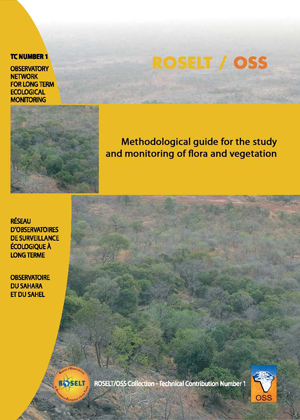
The guide aims to provide a harmonized methodological approach to the collection, processing, and analysis of data relative to flora andvegetation (other Guides cover the other components of bio-physical systems).The essential aim of the guide is to set out the joint approaches to zoning, sampling,and measurement of parameters that were chosen within the ROSELT/OSS frame-work. It also addresses the principle methods used to analyze results, covering diverse activities from the development and measurement of new indicators to thecalculation and interpretation of indexes. In the second part of this document, thecontents of the following chapters will be logically laid out:– zoning and sampling of space (Chapter I);– evaluation and monitoring of vegetation, surface states, and resources (Chapter II); – evaluation and monitoring of biodiversity at diverse spatial levels(Chapter III);– evaluation and monitoring of the ecological diversity of landscapes(Chapter IV).

ROSELT
Study & Monitoring of flora and vegetation
Environmental Monitoring & Biodiversity
Studies & Reports
OSS
978-9973-856-51-7
2011

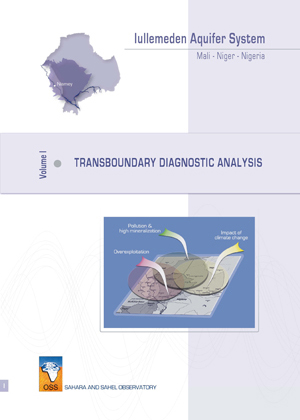
The Transboundary Diagnostic Analysis approach, advocated by the GEF for International Waters, was applied to the water resources of the Iullemeden Aquifer System. It is a first on the African continent.

It is an objective assessment of scientific and technical facts based mainly on using the best information available and checked. It is made of trans-sectional manner, focusing on transboundary issues without ignoring national concerns and priorities. The TDA is used to determine the relative importance of the sources, causes and impacts on transboundary issues in water. Its objectives are:

to identify, to quantify and to set priorities for environmental problems that are transboundary in nature;
to identify their immediate, underlying and root causes.
The main steps of the TDA are: 1) the analysis of impacts and consequences of each transboundary issue, 2) the final prioritization of transboundary issues, 3) the causal chain analysis and governance analysis, 4) the production and the adoption of the full document of the ADT by the Steering Committee.

Through TDA, three major transboundary risks have been identified: (a) the decrease of the water resource, (b) the degradation of water quality, and (c) the impacts of climate variability / change. This activity obviously required the development of a database of more than 17 200 water points, a Geographic Information System and a mathematical model. This mathematical model, among others, highlighted the overexploitation since 1995 and an interconnection between the Niger River and groundwater.

In the interest of good governance of this common strategic resource, countries have adopted a Memorandum of Understanding to establish a legal and consultative framework for joint management and for rational and equitable exploitation.

GICRESAIT
Transboundary diagnostic analysis
Water Resources Management
Studies & Reports
OSS
978-9973-856-50-0
2011

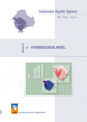
The hydrogeological modelling undertaken under the project “Managing hydrogeological risks in the Iullemeden Aquifer System (SAI)” is part of the Transboundary Diagnostic Analysis (TDA). His goal is to better assess water resources of this aquifer system and to identify hydrogeological risks associated.

OSS has proposed to carry out this model with the national team’s contribution in view to provide to the three countries a powerful tool for managing the shared water resources. This is a critical analysis of available information and identifying its practical limitations in improving knowledge about the behaviour of the aquifer system and the identification of hydrogeological risks associated to the water resource abstraction increasingly intensive.

This document presents a hydrogeological water balance of the aquifer system with its different components: recharge, hydrogeological characteristics (structure, hydraulic head, and water quality), abstraction and seepage.

Using the model as a tool for simulation of the aquifer system can develop scenarios for developing its water resources. It allows to reach the planning goals in the three countries and to identify the impact of withdrawals on the aquifer system behaviour and risks trends.

This document is a summary of the effort made by the project team at OSS and national experts associated in the collection, formatting relevant data for modelling and conceptualization of the hydrodynamic behaviour of this system, and its connections with the environment.

GICRESAIT
Hydrogeological Model
Water Resources Management
Studies & Reports