


Approval Date
November 10, 2017
Project Duration
3 years (2018-2021)
Project Status
Ongoing
Total Budget: 2 009 550 €
Amount of funding
1 499 550 €
Financial Partners
Coordination
The Sahara and Sahel Observatory is the leader of the North Africa Consortium
Technical partners
- African Regional Center for Space Science and Technology in French Language affiliated to the UN (CRASTE-LF), based in Rabat (MOROCCO).
- Regional Remote Sensing Center for North African States (CRTEAN), based in Tunis (TUNISIA).
- Algerian Space Agency (ASAL), based in Algiers (ALGERIA).
- National Center for Cartography and Remote Sensing (CNCT), based in Tunis (TUNISIA).
- Royal Center for Remote Sensing Space (CRTS), based in Rabat (MOROCCO).
- Desert Research Center (DRC), based in Cairo (EGYPT).
- Libyan Center for Remote Sensing and Space Sciences (LCRSSS), based in Tripoli (LIBYA).
- Université Asriya de Nouakchott (Mauritania), based in Nouakchott (MAURITANIA).
Countries of operations
Algeria, Egypt, Libya, Morocco, Mauritania and Tunisia
Main beneficiaries
National institutions of the countries concerned in charge of environmental management, agriculture and water.
Objective
Funded by the European Union through the Commission of the African Union, the "Support Project for the Sustainable Management of Water and Natural Resources through the Exploitation of Earth Observation Data and Technologies" of the GMES & Africa Program, aims to support decision making in the field of sustainable management of water and natural resources through the provision of products and services developed from the data and Earth Observation techniques.
Services to be developed by the project
- Agricultural seasonal monitoring and Early warning
- Water abstraction assement and monitoring water use in irrigated areas
- Land degradation monitoring
Main Project activities
- Analysis of remote sensing products end-users needs
- Diagnosis of the existing approaches and methods of observation
- Design and development of geospatial services and databases
- Boosting a network of partners
- Development of a web based knowledge sharing platform
- Capacity building and awareness raising
Expected Outcomes
The capacities of national partners on the use of geospatial services for monitoring and management of natural resources in support of their sustainable development strategies are enriched and strengthened through:
- Methods and models for water, natural resources and crop monitoring
- Operational Earth Observation based services in support to decision making
- Information systems for data sharing
- Integration of Earth observation in natural resources management
Main Achievements
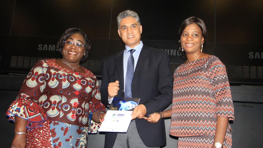
- Formalization of Agreement arrangements between the AUC and OSS
- Organization of the kick-off meeting bringing together national and regional partners to present the project and to validate proposed actions plan
- Establishment of partnership agreements which defines all activities to be carried out, milestones and deliverables for each partner
- Elaboration of national studies on “The analysis of the needs expressed by end users, the diagnosis of the existing in terms of ongoing projects and actions, in relation to the three GMES services, and the definition of the three services"
- Definition of the regional studies: 1) “State of play of ancillary data: challenges and alternatives will be conducted by CRTEAN, 2) Development of distance learning tools”: will be conducted by CRASTE-LF, and 3) “Advocacy: remote sensing in support of SLM monitoring”: will be conducted by OSS
- Gathering of Sentinel-2 data and pre-processing over the GMES-NA action zone in preparation for related activities
- Participation to several events :
- 2nd international conference TEANGEO2018 : Tunis, 26 - 28 September 2018
- 1st GMES Forum: Libreville, 19 to 23 November 2018
- UNFCCC CoP 24: Katowice, 3 to 14th December 2018
- Training workshop on monitoring and evaluation: Tunis, 19-22 February 2019
- 1st GMES African Continental workshop : Dakar, 6-10 may 2019
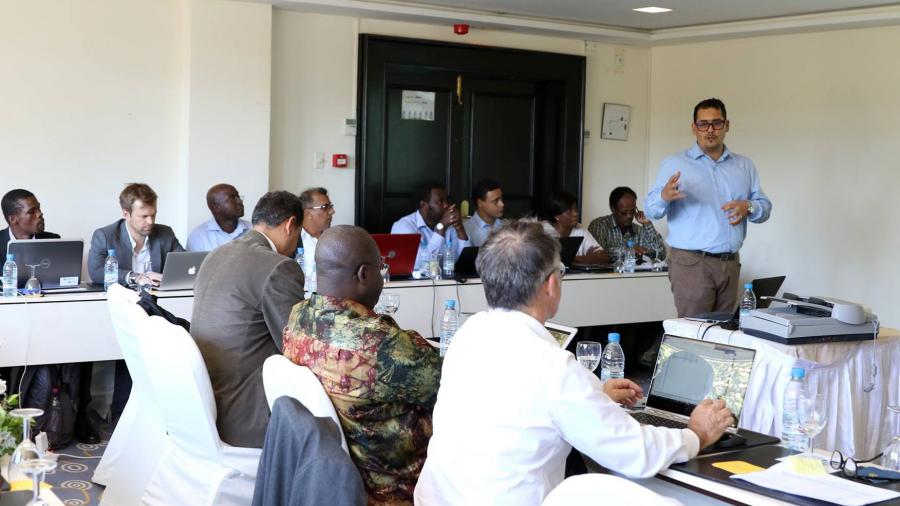
- Organization of National and Regional Workshops:
- GMES & Africa - North Africa Project Kick-off Meeting: Tunis, 10-11 October 2018
- National workshop on earth observation services in Libya: Tunis, 8 - 9 April 2019
- National workshop to present the national study and reflect on earth observation services in Algeria: Azrew, 17-18 April 2019
- Regional workshop for the restitution of national studies and reflection on earth observation services: Rabat, Morocco, 16-17 July 2019
- National workshop on the restitution and reflection on earth observation services in Morocco: Rabat, Oct. 4, 2019
- National workshop on the restitution and reflection on Earth Observation Services in Tunisia: Tunis, 23 Oct. 2019
- Tele-training on operational modeling of wheat growth and its yield estimate organized within the framework of the AfriCultuReS and GMES-Africa projects in partnership with the CNCT (National Center for Mapping and Remote Sensing) - ONAGRI (National Observatory of Agriculture) and INRGREF (National Institute for Research in Rural Engineering, Water and Forests), 20 to 22 April 2020
- Regional workshop to present the progress of the project, and to discuss the next activities to be carried out by the end of the 1st phase, April 27, 2020